NetAdvantage improves Mapping

New version adds support for various geographic providers including OpenStreetMap, Bing Maps and Esri ArcGIS.
Abril 25, 2013
Nuevas funcionalidades

Infragistics NetAdvantage for WPF includes stylable user interface controls for geospatial mapping, interactive gauges, graphical timelines, animated charting and OLAP pivot grids. Use these UI controls to produce OLAP pivot grids, charts, maps, gauges, timelines, bullet graphs and barcodes.

Updates in 2013 Volume 1

  • Doughnut Chart - Display multiple series of data, represented by rings drawn around the hole.
  • Syntax Parsing Engine - Includes lexing/parsing, document searching, syntax trees, error reporting, document navigation and EBNF support.
  • Syntax Editor - The Syntax Editor has been updated with support for SQL as well as additional visual highlighting options such as visible whitespace, current line highlight and a ruler margin.
  • Menu/Context Menu - With improvements to the Menu and Context Menu controls, NetAdvantage now supports the ICommand interface.
  • Gantt - Better compatibility with MS Project 2010.
  • Geographic Map - Display client-side and server-side data on various sources of imagery. A simplified API supports various geographic imagery providers including OpenStreetMap, Bing Maps, Esri ArcGIS and Cloudmade maps.
  • Data Chart - Use mouse or touch gestures to improve interaction.
  • Ribbon - Microsoft Office Application Menu 2010 (also referred to as Backstage) functionality so developers can add easy access to task-centered functions in their WPF applications.

About Infragistics

Infragistics has been the market leader in the presentation layer components industry for over 18 years. With a comprehensive portfolio of multi-platform Enterprise Software products and services, they have achieved global reach in nearly every Fortune 2000 company. Infragistics empowers developers to build and style great application user interfaces for Windows Forms, ASP.NET, WPF and JSF, and additionally offers user interface test tools, support, training and consulting services.
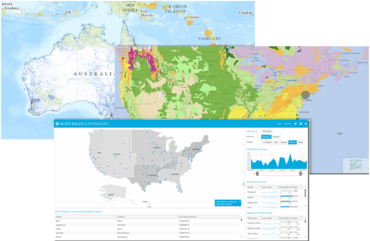
Interact with geographic map series.

Infragistics NetAdvantage for Silverlight

Achieve rich, advanced data visualization that leverages the sophisticated capabilities of Silverlight.

¿Alguna pregunta?

Chatee en vivo ahora mismo con nuestros especialistas en licencias de Infragistics.