
Handle Geospatial Data from Python with Ease
Product UpdateFile Conversion Tools
Aspose.GIS for Python via .NET gives developers the tools to read, write, analyze, and render GIS data, without relying on heavyweight GIS software.

APIs for programmatic geospatial data processing and conversion.

Prices from:
| Available as | Our Price |
|---|---|
| Aspose.GIS for .NET | Loading |
| Aspose.GIS for Python via .NET | Loading |
| Also available in Aspose.Total | |
|---|---|
| Aspose.Total for .NET | Loading |
| Aspose.Total for Python via .NET | Loading |
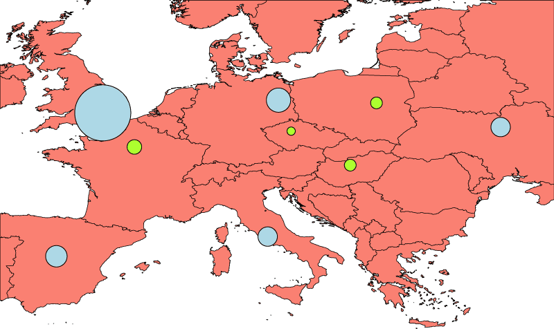
The APIs support reading and writing common vector GIS formats such as Shapefile, GeoJSON, and KML. Applications can load existing datasets, create new layers, and convert data between supported formats for interoperability across geospatial systems.
Aspose.GIS enables applications to work with vector layers and their features programmatically. Developers can access feature attributes, iterate through records, add new features, and update or remove existing entries within geospatial datasets.
The libraries provide classes for creating and modifying geometric objects such as points, linestrings, and polygons. Applications can perform geometry based operations, enabling spatial data transformation and preparation for analysis.
Developers can assign and transform spatial reference systems for geospatial data. The APIs support coordinate system definitions and reprojection of geometries, allowing datasets to be aligned across different mapping standards.
Aspose.GIS includes spatial operations such as intersection, union, buffering, and containment checks. Applications can analyze relationships between geometries and generate derived spatial data as part of automated processing pipelines.
The APIs allow access to attribute tables associated with vector features. Developers can read, update, and manage field definitions and attribute values, supporting integration of spatial and non spatial data within business applications.
Applications can convert geospatial datasets between supported formats while preserving geometry and attribute information. This enables migration, integration, and exchange of spatial data across different GIS platforms and systems.
Aspose.GIS is available for .NET and Python via .NET, enabling integration of geospatial processing features into desktop, web, and server side applications across supported development environments.
Review the details below to ensure this product is supported within your environment.
Choose the platform you need.
Product UpdateFile Conversion Tools
Aspose.GIS for Python via .NET gives developers the tools to read, write, analyze, and render GIS data, without relying on heavyweight GIS software.
Aspose, founded in 2001 and headquartered in Lane Cove, Australia, develops APIs and components for document processing, file conversion, and content management across a wide range of platforms. Its product portfolio supports formats including Word, Excel, PDF, PowerPoint, Outlook, CAD, imaging, and barcode technologies for .NET, Java, C++, Python, Node.js, Android, and cloud environments. The company focuses on helping developers work with complex file formats without requiring third-party applications. With broad platform compatibility and extensive format support, it enables organizations to build automated document workflows, reporting systems, and enterprise applications.

As official and authorized distributors since 2006, ComponentSource supplies you with legitimate licenses directly from Aspose.