Syncfusion .NET MAUI Maps
A customizable .NET MAUI maps control for rich geographical data visualization.
- Render geographical areas using GeoJSON or shapefiles with shape layers.
- Integrate online map tiles from providers like OpenStreetMap and Bing Maps.
- Add markers, bubbles, legends, tooltips, zooming, and panning for interactivity.

Prices from:
| Available in | |
|---|---|
| Syncfusion Chart SDK | Loading |
| Syncfusion Essential Studio UI Component Suite | Loading |
| Syncfusion Essential Studio Enterprise | Loading |
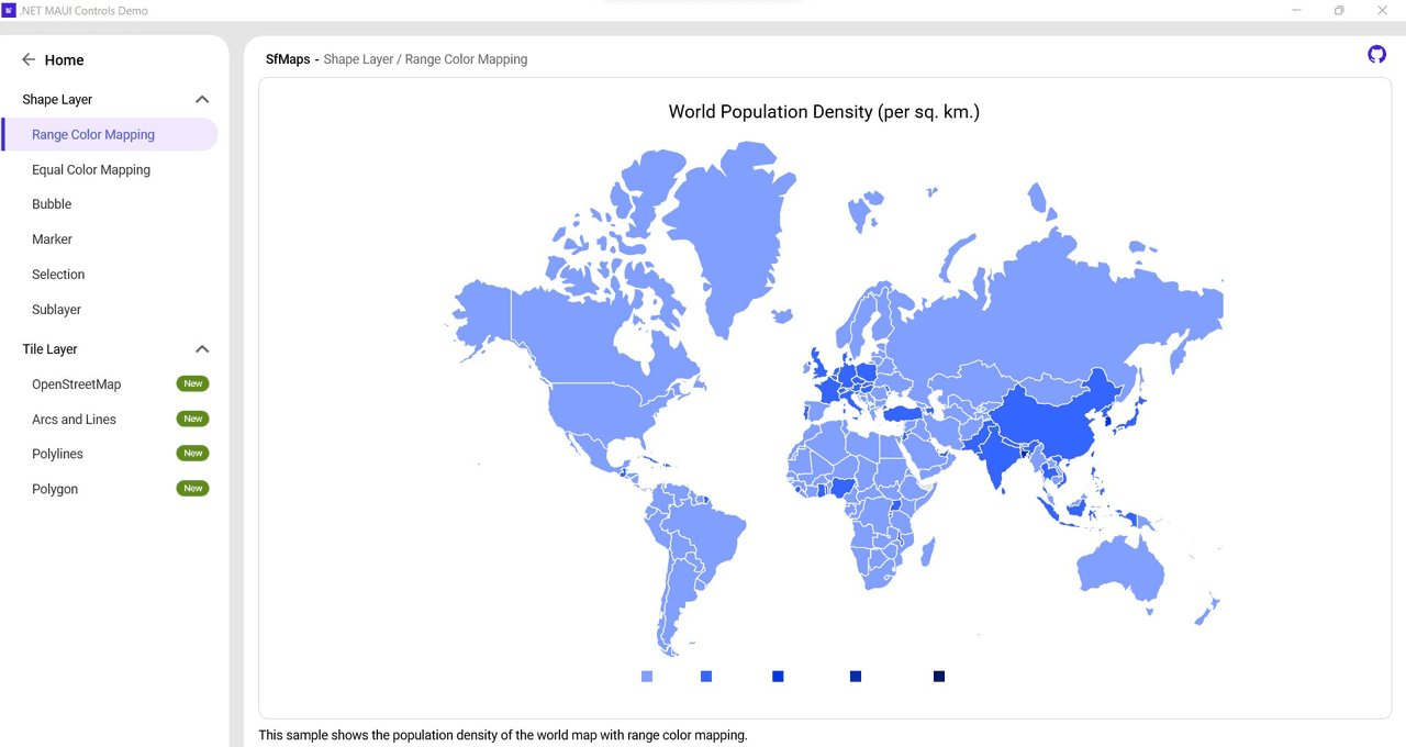
Shape Layer Rendering
Visualize geographical areas and custom shapes by loading GeoJSON or shapefile data as shape layers, allowing rich data representation for regions such as countries, states, or custom floorplans.
Tile Layer Support
Display map tiles from various online providers including OpenStreetMap, Bing Maps, Google Maps, TomTom, and others, using web map tile services to compose interactive map images.
Markers for Location Identification
Add customizable markers at specific latitude and longitude coordinates on both shape and tile layers, supporting built-in shapes or custom content to highlight important locations.
Bubbles for Data Visualization
Represent statistical data such as population density or user distribution using bubbles with customizable colors and sizes mapped to underlying data values for enhanced readability.
Legends for Data Interpretation
Provide clear explanations of map symbols and colors through shape and bubble legends, which can be positioned on any side of the map to improve user understanding.
Tooltips for Additional Information
Attach tooltips to shapes, bubbles, and markers that display extra contextual information when users tap, click, or hover, enriching the interactivity and insight of the maps.
Color Mapping Techniques
Categorize map shapes and bubbles by applying equal or range-based color mappings based on data attributes, aiding in visual differentiation of geographical data.
Selection and Highlighting
Enable selection of map shapes to highlight specific regions, facilitating navigation, user focus, and triggering additional functionality related to the selected area.
Zooming and Panning
Support intuitive interaction such as pinch-to-zoom and panning gestures or mouse wheel/trackpad scrolling to navigate and explore map regions in detail.
Integration and Customization
Provide simple API-based integration in .NET MAUI applications with handlers registration, namespace imports, and extensive customization options suitable for enterprise and mobile environments.
Product Compatibility
Review the details below to ensure this product is supported within your environment.
Component Type
- .NET
.NET Version
- .NET 10 LTS
- .NET 9 STS
.NET Platform
- .NET MAUI
IDE Support
- Visual Studio
About Syncfusion
Syncfusion, founded in 2001 and headquartered in Morrisville, North Carolina, develops UI components, document SDKs, and developer tools for web, mobile, and desktop application development. With thousands of customers in more than 125 countries, it serves a diverse client base from individual developers to Fortune 500 enterprises. Its Essential Studio product range includes controls and frameworks for Blazor, React, Angular, Vue, JavaScript, ASP.NET Core, WinForms, WPF, WinUI, .NET MAUI, and Flutter. The company focuses on components such as DataGrids, Charts, Schedulers, Gantt Charts, Diagrams, Rich Text Editors, as well as PDF, Word, Excel, and PowerPoint libraries, helping developers build business applications across established development platforms.

As official and authorized distributors since 2002, ComponentSource supplies you with legitimate licenses directly from Syncfusion.