Syncfusion WinForms Map
Visualize geographic data with interactive and customizable WinForms maps.
- Supports rendering geographical shapes and custom shapes from shapefiles or GeoJSON.
- Features interactive zooming, selecting, panning, and tooltip support.
- Enables data-driven visualizations using color mapping, bubbles, and annotations.

Prices from:
| Available in | |
|---|---|
| Syncfusion Chart SDK | Loading |
| Syncfusion Essential Studio UI Component Suite | Loading |
| Syncfusion Essential Studio Enterprise | Loading |
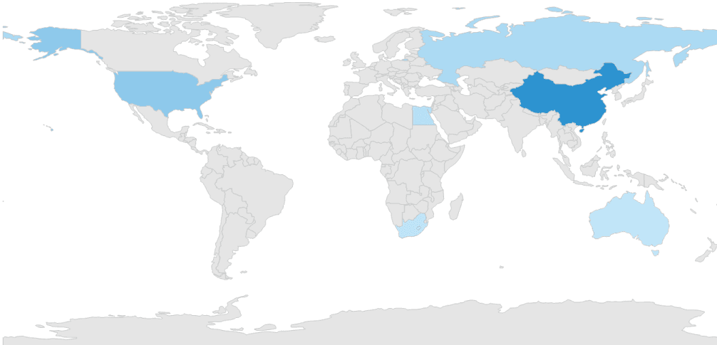
Shape Layer Rendering
Bind shapefiles (.shp) or GeoJSON (.json) files to the map to display geographical or custom shapes with customizable styles including color, stroke, and thickness.
Multiple Shape Sublayers
Combine multiple shapefiles within a single map view, allowing layered visualization of geographic features such as rivers, valleys, and cities.
Data Labels
Add and customize labels to annotate shapes for enhanced readability using adjustable font styles, sizes, and colors.
Heat Map Visualization
Create heat maps that color map shapes based on underlying data values, supporting equal and range color mapping to highlight differences like election results or population density.
Map Annotations
Mark locations with various annotation types including pins, geometric shapes, or custom images to highlight points of interest on the map.
Map Bubbles
Display bubbles over shapes to represent quantitative data, with customizable size ranges, colors, and transparency to emphasize underlying values.
User Interaction Features
Provide an interactive user experience with zooming, panning, shape selection to center views, and tooltips displaying detailed information on map elements.
Easy Integration and Data Binding
Integrate into Windows Forms applications with simple APIs and bind to external data sources for dynamic, data-driven maps.
Product Compatibility
Review the details below to ensure this product is supported within your environment.
Component Type
- .NET
.NET Version
- .NET 10 LTS
- .NET 9 STS
- .NET 8 LTS
- .NET 4.8 or earlier
.NET Platform
- .NET WinForms
IDE Support
- Visual Studio
About Syncfusion
Syncfusion, founded in 2001 and headquartered in Morrisville, North Carolina, develops UI components, document SDKs, and developer tools for web, mobile, and desktop application development. With thousands of customers in more than 125 countries, it serves a diverse client base from individual developers to Fortune 500 enterprises. Its Essential Studio product range includes controls and frameworks for Blazor, React, Angular, Vue, JavaScript, ASP.NET Core, WinForms, WPF, WinUI, .NET MAUI, and Flutter. The company focuses on components such as DataGrids, Charts, Schedulers, Gantt Charts, Diagrams, Rich Text Editors, as well as PDF, Word, Excel, and PowerPoint libraries, helping developers build business applications across established development platforms.

As official and authorized distributors since 2002, ComponentSource supplies you with legitimate licenses directly from Syncfusion.