Acerca de MindFusion.ASP.NET Pack

Componentes de programación, diagramas, gráficos, mapas e interfaz de usuario para aplicaciones ASP.NET.

MindFusion.ASP.NET Pack helps you create applications that include diagrams, charts, schedules, maps and a rich user interface. Each of the controls is extremely easy to use and customize. It also includes several samples, detailed documentation and step-by-step guides.

MindFusion.ASP.NET Pack Features

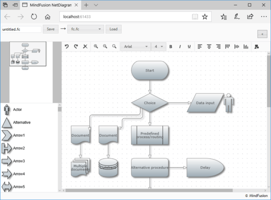
  • Diagramming - Supports several user interaction modes, scrolling and zooming, tables, automatic graph layout algorithms, undo/redo, programmatic access to diagram objects and selections. Once your diagram is ready you can export it into variety of files, print it, save it as an image or view it in a web page.
  • Scheduling - Create calendars and timetables and allows users to edit schedule information interactively. You can fully customize its appearance, define recurring events or export the schedule to XML. Built-in forms help you create or edit items, define events or want to show items that are hidden in the current view.
  • Charting - Create any type of bar, line, area, pie or radar chart with an unlimited number of data series. Other features include zooming, second Y-axis, 3D charts and XML serialization. It also includes a built-in gauge control that supports oval, horizontal and vertical linear gauges.
  • UI Controls - A rich set of UI controls including a dock control, tab control, accordion control and several data input controls. It also comes with a variety of smaller but useful components including slideshow, zoom, menu, calendar, different pickers and numeric up and down. The appearance of all the controls can be customized through themes.
  • Mapping - A powerful webforms component that lets you create maps in minutes and decorate them with any number of layers of notable data. The control comes with an extensive set of ESRI shapefiles that provide geographical and administrative data. Large maps can be scrolled and panned, the appearance of each map is fully customizable. You can also render street maps in the OpenStreetMap format.