


공식 공급 업체
200 이상의 소프트웨어 개발처와 판매 계약을 맺은 공인 디스트리뷰터로서 합법적인 라이선스를 제공합니다.
모든 브랜드 보기.
영어로 계속 읽기:
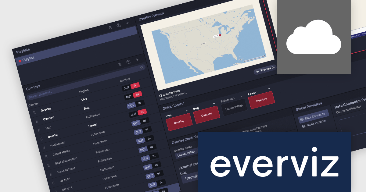
everviz is a cloud-based data visualization platform that empowers users to create visually appealing, interactive and customizable charts, maps, and other visuals. It provides a user-friendly interface that doesn't require any code or design skills, allowing users to quickly generate responsive visualizations with built-in support for accessibility. Whilst facilitating consistent branding and collaboration, the platform provides the flexibility to embed these visualizations into web applications, or share them directly, and enables users to effectively engage with viewers across devices.
The latest update of everviz officially launches the Location Maps feature. Now available in the Enterprise edition, this feature allows users to instantly create interactive maps that can be integrated across all platforms, for example, into video packages, live streams, online articles and social media posts. It comes with animation and map zooming effects to highlight specific areas, as well as customizable themes so that users can incorporate colors, fonts, and logos to match their brand aesthetics. This enables users to present geographic data in various media formats and without coding or design skills, making content more engaging and appealing.
To see a full list of what's new, see our release notes.
everviz is available in two editions: Pro and Enterprise, both of which are annual subscription licenses that include support. See our everviz licensing page for full details.
For more information, see our everviz product page.
전화 : 00798 14 800 6332
팩스 : +1 770 250 6199


