


공식 공급 업체
200 이상의 소프트웨어 개발처와 판매 계약을 맺은 공인 디스트리뷰터로서 합법적인 라이선스를 제공합니다.
모든 브랜드 보기.
영어로 계속 읽기:
DataGrip is a multi-engine database environment that supports MySQL, PostgreSQL, Microsoft SQL Server, Oracle, Sybase, DB2, SQLite, HyperSQL, Apache Derby and H2. It includes an editor that provides intelligent coding assistance such as auto-completion, analysis and navigation. It also features a query console for running and profiling queries.
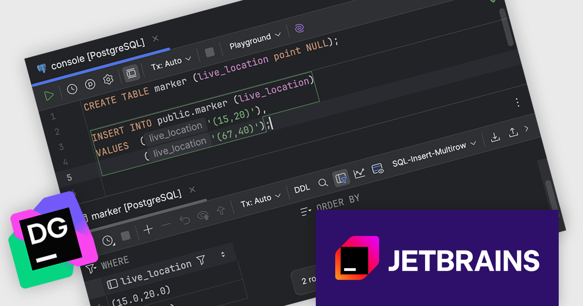
The JetBrains DataGrip 2025.1 release introduces a valuable new feature that improves working with spatial databases. DataGrip can now display raw geo-type values directly within the data grid for PostgreSQL, MySQL, and MariaDB databases. This enhancement enables developers and database administrators to view spatial data like coordinates, geometries, and other geo-types in their original format without needing additional conversions or external tools. This update makes spatial data management more efficient, accurate, and accessible within the everyday development environment.
To see a full list of what's new in version 2025.1, see our release notes.
DataGrip is licensed per user, and is available as a commercial annual subscription license. We can supply new subscriptions, subscription renewals, lapsed renewals, and additional user licenses. See our DataGrip licensing page for full details.
DataGrip is available to buy in the following products:
전화 : 00798 14 800 6332
팩스 : +1 770 250 6199


