
MindFusion.Mapping for WinForms
A full set of features to create, customize and display maps.
Published by MindFusion Group
Distributed by ComponentSource since 2003
Prices from: $ 294.00 Version: 2.0 Updated: Nov 3, 2015
A full set of features to create, customize and display maps.
Published by MindFusion Group
Distributed by ComponentSource since 2003
Prices from: $ 294.00 Version: 2.0 Updated: Nov 3, 2015

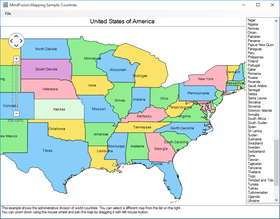
MindFusion.Mapping for WinForms can load, customize and display any type of regional, national or world map. Map data can be loaded from ESRI shapefiles and it includes data for any country in the world as well for selected cities, rivers, roads and other geographic objects. Data for the attributes of map elements can be loaded from a DBF file associated with each map. It's also possible to load OpenStreetMap XML files to display city and road maps. The control supports multiple layers so you can show several maps in a single view.

MindFusion.Mapping for WinForms Features
MindFusion.Mapping for WinForms is also available in:
Live Chat with our MindFusion Group licensing specialists now.


Tel: (888) 850 9911
Fax: +1 770 250 6199


